Karlsøy - English outing cards
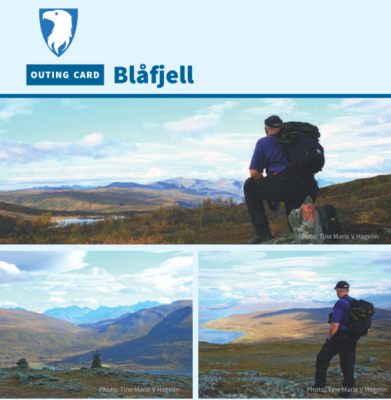
Blåfjell
This is a child friendly and easy outing for the whole family. The mountain lies between Grunnfjord, Hansnes and Dåfjord villages, and is a popular recreation area year round. The path is a great evening trip in the summer with nice resting areas along the way. About halfway up is a rustic shelter with a fire pit and kindling. The route offers beautiful views over Langsundet and the islands of Vannøya, Karlsøya and Reinøya. From the cairn at the top you can see large parts of Karlsøy municipality. Have a good trip!

Haugland Farm
Haugland farm on Hersøya is a designated outdoor recreation area and is idyllically located in Vargsundet sound. The island is part of Nordkvaløya - Rebbenesøya Landscape Conservation Area. Hersøya island is a popular outdoor area with a rich plant and birdlife. Haugland farm is the first place Jan Baalsrud sought refuge on his hard journey to Sweden in 1943. Today, the house is completely renovated and you can stay here for a reasonable price via Karlsøy Hunting and Fishing Association. Perfect for a weekend family getaway!

Indianeren/Torstinden
Indianeren is an easy summit northwest on Vannøya island. The trail starts on the right side of the road approximately 5 km after the intersection to Burøysund. Here is a view of Kåja with the lighthouse closest, and the islands of Helgøya and North Kvaløya in the sea further west. The trail is well marked. After a short mile (about 25 minutes), you reach Indianeren. This is a nice rest area with benches, tables, fire pit, and creative figures erected by a local artist. Continue on the path to reach Torstinden.
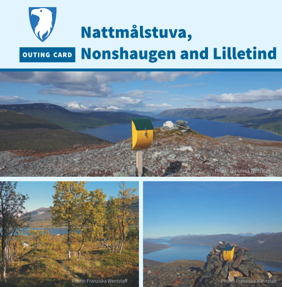
Nattmålstuva, Nonshaugen and Lilletind
At Gamnes on Ringvassøya there are three hikes suitable for families with kids and afternoon/weekend hikes. There are marked trails leading to Nattmålstuva (333 MASL, green), Nonshaugen (342 MASL, green) and Lilletind (608 MASL, blue). All three hikes start on the gravel road, merging into a trail along the stream. Just above the tree line you can reach the three tops in easy terrain. From here you can enjoy a fantastic view towards Vannøya, Langsundet, Reinøya, and Soltindan.
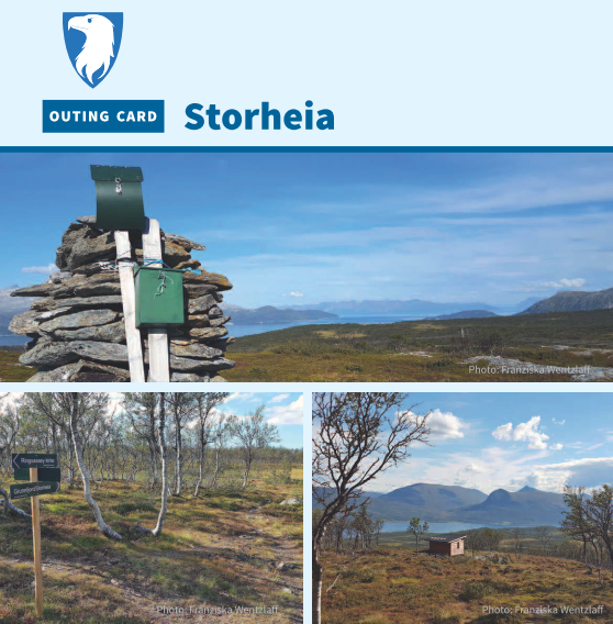
Storheia
Storheia is a family friendly peak in hilly terrain above Hansnes’ municipality centre on Ringvassøya. It is part of a hike between Hansnes and Grunnfjorden, and just before the top of Storheia there is a rustic shelter for common use. The shelter is a nice spot for a break in nature with a good view of the sea and the islands around. Here you find a great view from only 306 MASL. With mountains, forests, marshes and hills, the areas around Storheia are well suited for exploratory children.
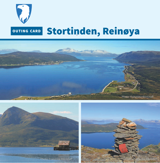
Stortinden, Reinøya
Approaching Stortinden peak on Reinøya island, you get a great view from the top. From Reinskar's ferry dock, you immediately start the steep incline, but it isn’t long before your toil is rewarded with a view. At the top of Stortinden you are 568 MASL and you can enjoy a great view of Reinøya’s mountains and valleys. In the south-west direction Ringvassøya towers with its mighty mountains, among them the highest mountain in the municipality, Soltindan. To the north, you will see Vannøya and Vanntinden.
Siste nyheter
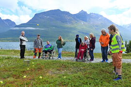 Turkalenderen for årets 10 tilrettelagte turer er klar
Har du lyst på en ettermiddagstur eller søndagstur og oppleve nye friluftsområder i vår vakre region? Vi og våre samarbeidspartnere arrangerer 10 ture...
Les mer
Turkalenderen for årets 10 tilrettelagte turer er klar
Har du lyst på en ettermiddagstur eller søndagstur og oppleve nye friluftsområder i vår vakre region? Vi og våre samarbeidspartnere arrangerer 10 ture...
Les mer
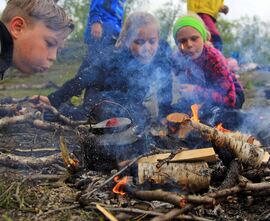 Friluftsskoler 2026- meld deg på sommerens kuleste eventyr!
Nå er påmeldingen til friluftsskolene i Lyngen, Karlsøy, Tromsø, Storfjord og Balsfjord kommuner åpne. Er du mellom (8)10-13 år? Har du lyst til å lær...
Les mer
Friluftsskoler 2026- meld deg på sommerens kuleste eventyr!
Nå er påmeldingen til friluftsskolene i Lyngen, Karlsøy, Tromsø, Storfjord og Balsfjord kommuner åpne. Er du mellom (8)10-13 år? Har du lyst til å lær...
Les mer
 Vi søker lærer i 50%-stilling!
Vi søker etter en prosjektmedarbeider med pedagogisk kompetanse og som brenner for uteskole og læring i friluft. Vi ser etter en person med stor frilu...
Les mer
Vi søker lærer i 50%-stilling!
Vi søker etter en prosjektmedarbeider med pedagogisk kompetanse og som brenner for uteskole og læring i friluft. Vi ser etter en person med stor frilu...
Les mer