Balsfjord - English outing cards
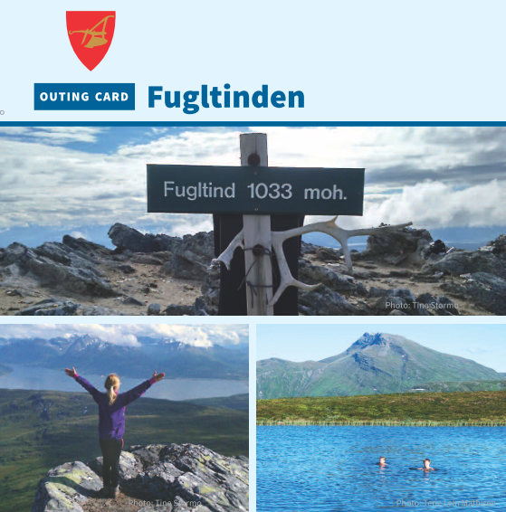
Northeast of Storsteinnes lies the majestic Fugltinden peak. The mountain rests where Balsfjord arches in a large bow to the north and east and with Malangen to the west with its fjord arm Nordfjord. You will feel surrounded by the sea from the beginning to the top. The view stretches in all directions so a midnight sun trip to Fugltinden peak is highly recommended. The trip is relatively long and offers a lot of varied terrain with several little mountain lakes along the way. The view from the top is spectacular.

Holmevassfjellet
Holmevassfjellet (505 MASL) is a family friendly trip in easy, clear terrain. The mountain leans towards Balsfjorden’s eastern side offering a beautiful view of the fjordscape. The majestic Piggtinden peak is visible throughout. The path is well marked by Balsfjord Outdoor Association and is among the “ten tops” (10 på topp). Holmevassfjellet lies in a lush area with a rich vegetation on calcareous bedrock. Holmevatnet lake contains char, and the eastern shore has a nice picnic area. There is a cache at the top.
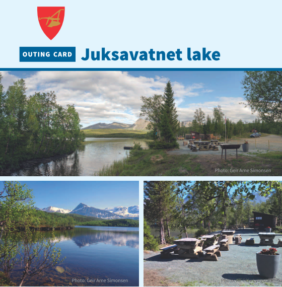
Juksavatnet lake
Juksavatnet lake is a family-friendly recreation area in Balsfjord Municipality. The area offers cultural history and opportunities for short outings around the idyllic lake and longer trips to Andorvatnet lake. The area is great for fishing, berry picking, and small game hunting. At the water is an established fire pit with nearby toilet and floating dock. From E6 take the Strupen exit, and continue to the road block at the lake. The path along the south side of Juksavatnet lake is wheelchair accessible. Have a good trip!
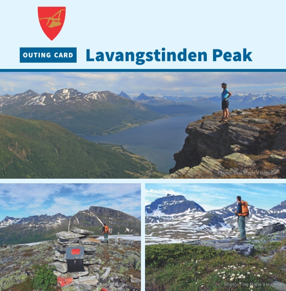
Lavangstinden peak
Lavangstiden peak is a relatively easy top with varied scenery and phenomenal views. The peak presides above as a massive wall on the southern end of the Lavangsdalen and the trip provides beautiful views of Balsfjorden and Lyngsalpene. The path is well marked and maintained by Balsfjord Outdoor Association with red marks. If you are lucky, thousands of flowering orchids will greet you at the start of the path. At the top there is a cache and many nice rest areas with a 360 panoramic view. Have a good trip!

Skredtind peak via Skogsbua
Want a peak trip with spectacular views? At Indre Malangseidet there is a beautiful marked trip to Skredtinden peak via Skogsbua. The trip has a lot to offer with nice streams and small waterfalls. The trail slopes down to the shore before a good long climb rises up to the peak. On the way up, each step is rewarded with ever better views. Upon reaching the top, 770 altitude meters have elapsed. From the top there is a beautiful view of Balsfjord and the surrounding mountains in all directions.
Siste nyheter
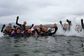
 Turkalenderen for årets 10 tilrettelagte turer er klar
Har du lyst på en ettermiddagstur eller søndagstur og oppleve nye friluftsområder i vår vakre region? Vi og våre samarbeidspartnere arrangerer 10 ture...
Les mer
Turkalenderen for årets 10 tilrettelagte turer er klar
Har du lyst på en ettermiddagstur eller søndagstur og oppleve nye friluftsområder i vår vakre region? Vi og våre samarbeidspartnere arrangerer 10 ture...
Les mer
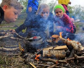 Friluftsskoler 2026- meld deg på sommerens kuleste eventyr!
Nå er påmeldingen til friluftsskolene i Lyngen, Karlsøy, Tromsø, Storfjord og Balsfjord kommuner åpne. Er du mellom (8)10-13 år? Har du lyst til å lær...
Les mer
Friluftsskoler 2026- meld deg på sommerens kuleste eventyr!
Nå er påmeldingen til friluftsskolene i Lyngen, Karlsøy, Tromsø, Storfjord og Balsfjord kommuner åpne. Er du mellom (8)10-13 år? Har du lyst til å lær...
Les mer
 Vi søker lærer i 50%-stilling!
Vi søker etter en prosjektmedarbeider med pedagogisk kompetanse og som brenner for uteskole og læring i friluft. Vi ser etter en person med stor frilu...
Les mer
Vi søker lærer i 50%-stilling!
Vi søker etter en prosjektmedarbeider med pedagogisk kompetanse og som brenner for uteskole og læring i friluft. Vi ser etter en person med stor frilu...
Les mer